Tag: Sustainability

  • On Red Tides: How Wang Mengqiu Is Tracking Algal Blooms With AI

    On Red Tides: How Wang Mengqiu Is Tracking Algal Blooms With AI

    Forests aren’t the only fragile ecosystems at risk from climate change. In the right conditions, Sargassum, a kind of macroalgae, can trap vast amounts of carbon and store it at the bottom of the ocean. But what happens when those conditions change? 

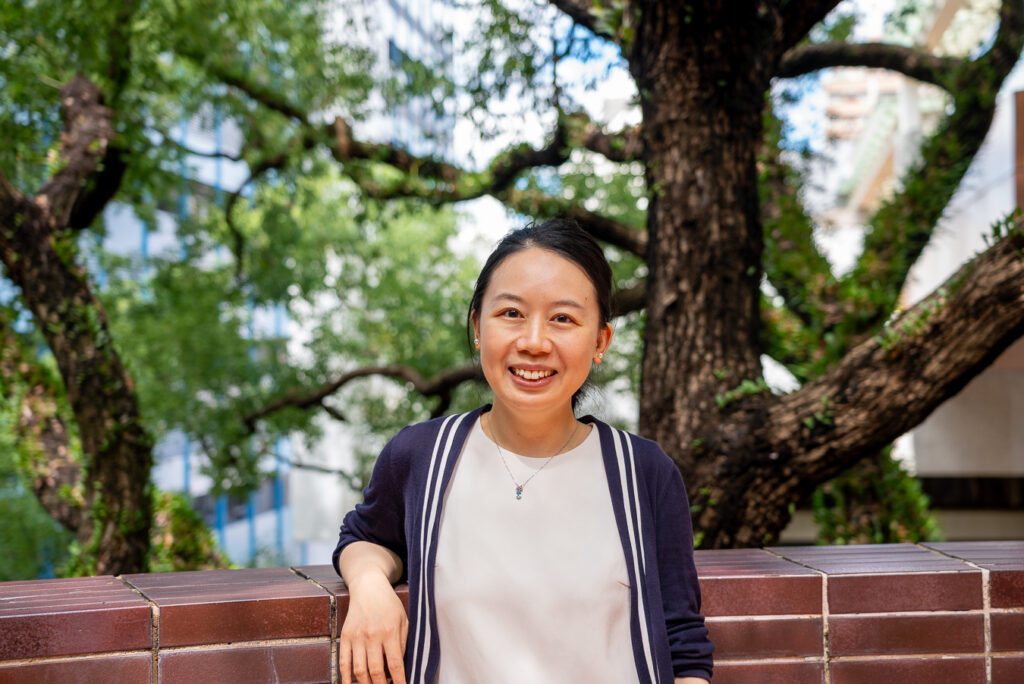
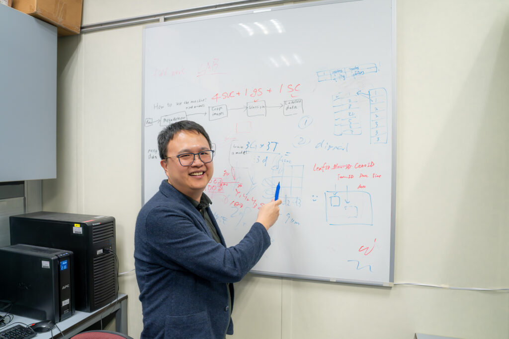
    The University of Hong Kong’s Professor Wang Mengqiu doesn’t want to wait to find out. Working with satellite imagery and advanced AI algorithms, she’s tracking oceanic conditions, monitoring blooms, and trying to answer an all-important question: How much of a given Sargassum bloom will become a carbon sink – and how much will wind up a carbon source? 

    Across the sea 

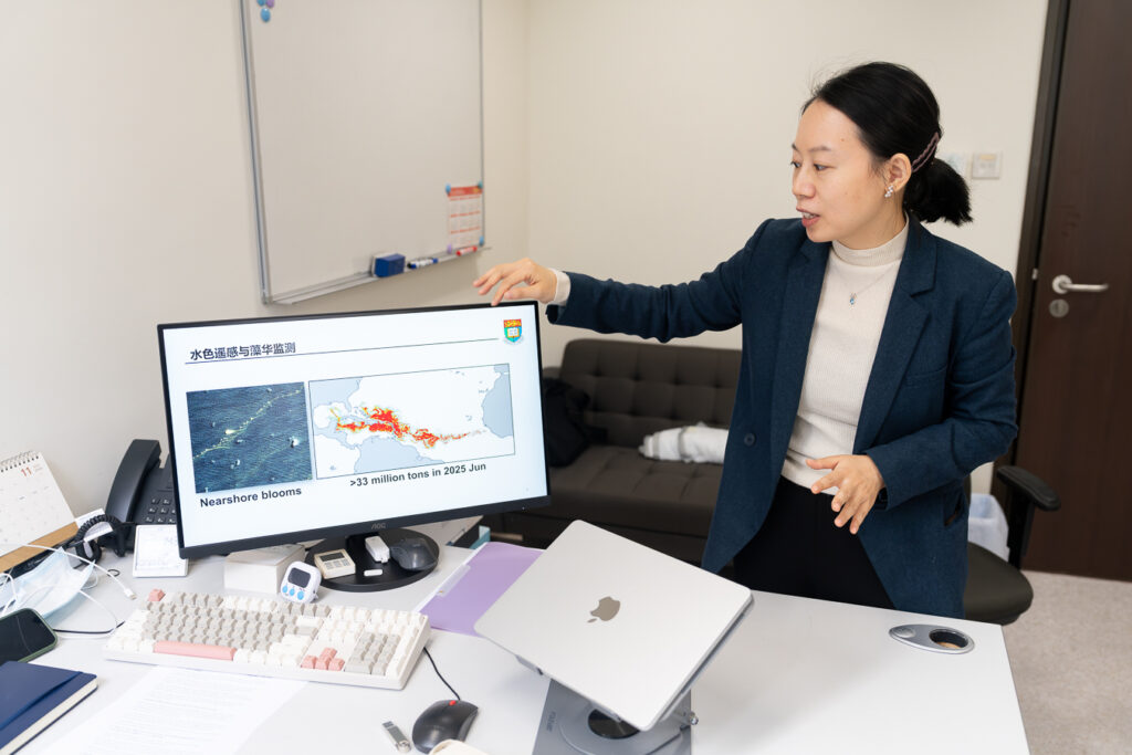
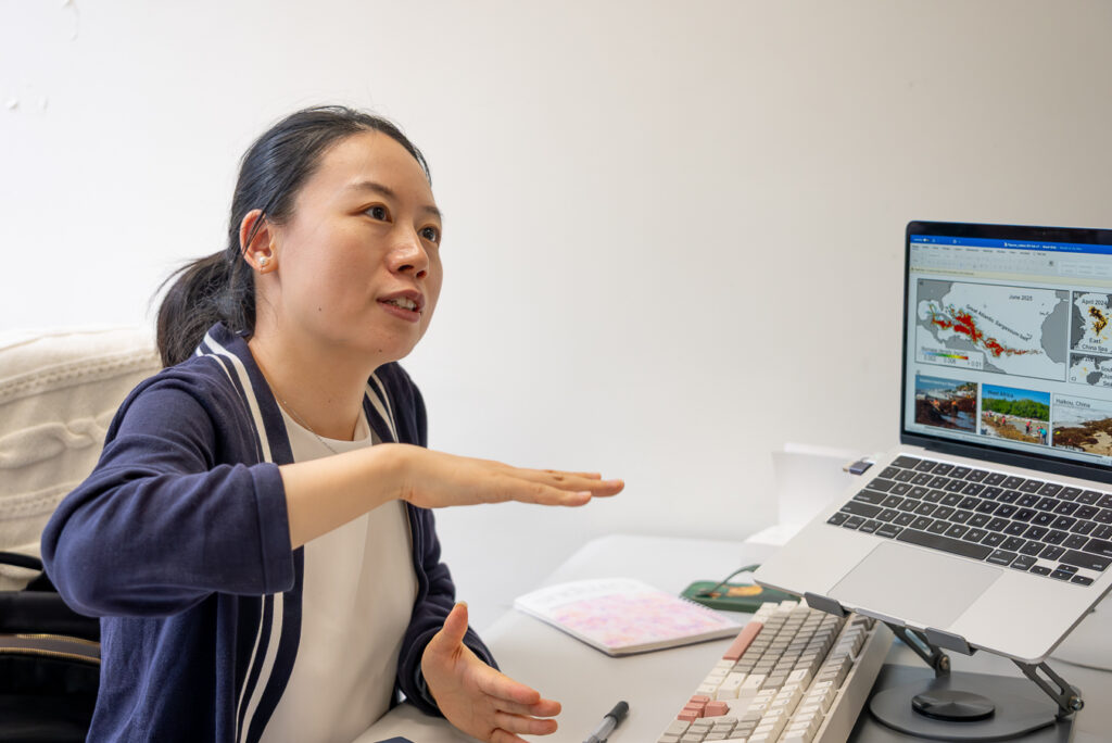
    The scale of Sargassum blooms can be hard to comprehend. To demonstrate what the planet is facing, Professor Wang pulls up a map showing the Great Atlantic Sargassum Belt, which stretches from the western coast of Africa across the ocean to the Caribbean and Mexico. 

    A recurring natural phenomenon, the Belt was observed as early as the late 15th century. “The ocean can benefit from Sargassum,” Professor Wang says, adding that they are “very big players in the ocean carbon cycle.” 

    Yet the Belt’s recent growth has worried researchers, as blooms set historical highs and landfall events in the Western Atlantic smother beaches and coastal wildlife.  

    “Satellites are an ‘eye in the sky,’ giving us a synoptic view of what’s happening below.” 

    – Professor Wang Mengqiu

    “In the open ocean, Sargassum acts as a carbon sink,” Professor Wang explains. “But if it reaches the coast, it releases hydrogen sulfide (a compound linked to asthma) and endangers coastal vegetation, including corals and seagrasses.” 

    Step one in addressing the problem is figuring out just how large the Belt has become – and where and when landfall events are likely to occur. But how do you measure something that spans an entire ocean? 

    Professor Wang shows the scale of the Great Atlantic Sargassum Belt
    Professor Wang shows the scale of the Great Atlantic Sargassum Belt

    AI in the sky 

    Typically, tracking Sargassum blooms might involve observations from a boat.  

    Both of these methods are expensive and time-consuming. So researchers like Professor Wang are turning to satellite and remote sensing technology, leveraging tools like AI and big data to quickly and efficiently identify Sargassum patches and map their locations. 

    Using satellites designed to monitor colour changes in the ocean, scientists can get a much better idea of how big the Belt – actually a thousands-of-miles-long stretch of discrete blooms – really is.  

    Although the underlying technology has been around since the 1980s, the field has benefitted in recent years from new hyperspectral sensors, higher-resolution images, and the shift from machine learning to deep learning. 

    “We don’t want to just react, we need to be able to make predictions.” 

    – Professor Wang Mengqiu

    The launch of NASA’s Plankton, Aerosol, Cloud, ocean Ecosystem (PACE) Satellite in 2024 was particularly exciting, Professor Wang says. “The satellite is a game changer because it’s hyperspectral,” she explains. “It will give us a much finer, more detailed knowledge of global changes.” 

    Previously, that level of detail would have been hard to analyse. But new deep learning techniques are making even hyperspectral imaging analysis possible, Professor Wang says. Her own work is one reason why: She just published a paper showing how to automatically de-noise images to better monitor algal blooms.  

    These advances will ultimately make it easier for scientists to predict the size and impact of future blooms, allowing for better management and mitigation. 

    Professor Wang explains her work using AI to track algal blooms
    Professor Wang explains her work using AI to track algal blooms

    The search for solutions 

    Professor Wang’s next project is to develop algal bloom distribution maps that can be used to guide policymaking. 

    The Atlantic isn’t the only ocean facing growing problems related to Sargassum. In the Yellow Sea and East China Sea, for instance, blooms have caused havoc in recent years.  

    Professor Wang hopes to work together with the Hong Kong government to understand public needs and design real-world applications for researchers’ growing trove of remote sensing data, including alarm systems for Sargassum landfall. 

    “The goal is to convert Sargassum into something useful: energy, building materials, or other applications.” 

    – Professor Wang Mengqiu

    While these ideas are still a long way off, she believes they could one day help mitigate or even eliminate the damage done by Sargassum to coastal ecosystems like Hong Kong’s – and even help vulnerable populations like the city’s fishers. 

    “I want to convert satellite products into something broadly useful,” she says. “As scientists, we have to serve the community.” 

    Professor Wang poses on the HKU campus
    Professor Wang poses on the HKU campus
  • Jin Wu Wants the World to See the Forest for the Trees

    Jin Wu Wants the World to See the Forest for the Trees

    When most people look at a forest, they see an example of nature at its best, a planetary lung that is one of our most reliable defences against climate change. But University of Hong Kong Professor Jin Wu sees something else: a delicately balanced ecosystem that, if not properly managed, could play havoc with earth’s future.

    That’s because not all forests are created equal. The Amazon, for example, was traditionally dominated by evergreen trees. More recently, however, a mix of environmental changes, drought, and human encroachment have led many of these to die off and be replaced by deciduous variants.

    While it’s too early to say how this will impact the climate, the end result could be a vicious cycle, Professor Wu says. As temperatures rise, trees need more water to sustain themselves. If the water runs low, more evergreens die and are replaced by deciduous trees, which do not transmit water from the soil to the air as efficiently. That means less rainfall and even more evergreen loss, releasing their stored carbon into the atmosphere as part of a process scientists call “Amazon dieback.”

    “People think of forests as a way to fight climate change, but they can also facilitate climate change.”

    – Professor Jin Wu

    All is not lost, however. Professor Wu and his team are among the many scientists working to understand and track changes underway in the Amazon, in his case, through satellite data and remote sensing. “Remote sensing lets us scale up the knowledge we have of individual leaves and plants to a global level,” Professor Wu says with a characteristic smile. “Then we can turn that global knowledge into science-based decision-making.”

    Professor Wu poses with his students in his lab
    Professor Wu poses with his students in his lab

    From tree to forest

    The field of remote sensing is developing quickly, thanks in large part to new tools like machine learning and AI algorithms, Professor Wu says. One of the most exciting developments his team is working on is using satellite data to track the chemical fingerprint of individual plants, offering an unprecedented window into forest composition.

    The idea comes from a 2009 study by ecologist Dr Greg Asner, who figured out how to identify individual plant species based on the chemical compositions of nitrogen and phosphorus. Because these plant chemical traits interact with light in different ways, satellite imagery could theoretically allow scientists to identify the functional composition of an entire forest.

    “Plants all have unique chemical fingerprints, and remote sensing plus AI can help us identify them.”

    – Professor Jin Wu

    The key hurdle is data. Commonly used hyperspectral imaging techniques are prohibitively expensive and time-consuming. A few years ago, generating a hyperspectral image for a 300-by-300-meter plot cost around HK$20,000.  

    In search of an alternative, Professor Wu’s team turned to a multispectral approach. By looking at 10 criteria across dense image time-series within a year – as opposed to the over 100 needed for hyperspectral imaging – they believe they can develop a complete picture of plant coverage and the underlying high-dimensional chemical compositions around the world at a fraction of the cost. 

    If it works, it could allow scientists to track how plant species are changing across both space and time. And that knowledge, Professor Wu says, might prove vital in the fight against climate change.

    Professor Jin Wu shows off some of the equipment he uses to monitor changes in forests.
    Professor Jin Wu shows off some of the equipment he uses to monitor changes in forests.

    Shrubs and CPUs

    Professor Wu and his team aren’t just looking at the Amazon. They’ve also trained a machine learning model to identify shrubs in the Inner Mongolian grassland. Long-term, they plan to map vegetation across the steppe, keeping an eye on this important ecosystem.

    Crucially, because their data is compatible with long-running databases, they can also look backward in time, allowing them to study the changes that have already taken place over the past 30 years. 

    “The field is evolving very quickly, and a lot of things we’ve never even dreamed of will soon be possible.”

    – Professor Jin Wu

    AI has helped make this possible, Professor Wu says, but the computational power needed represents a strain on the resources of smaller labs. Ideally, AI resources could be centralised so they benefit multiple teams at once – what he calls a “centralise and service” approach.

    Science with a smile

    Despite the challenges, Professor Wu remains optimistic about the future of remote sensing.

    His sunny attitude toward the sometimes slow speed of research progress is reflected not just in his near constant smile, but also in the list of advice for new PhD students on his office whiteboard, which includes both old saws like “be patient” and reminders to “be generous to yourself” and to not think of yourself as purely a helper. 

    Professor Wu stands in front of a whiteboard
    Professor Wu almost always has a smile on his face, even when explaining complex science.

    There’s also an item on there about the importance of the spirit of “discovery,” rather than just safely trying to refine existing methods. It’s advice he appears to have taken to heart, as even the mere mention of remote sensing’s prospects in the coming decades causes him to wax excitedly about new mechanisms and techniques that could revolutionise our understanding of the planet. 

    “This is an important field for the 21st century, and we’re well placed to connect science and policy,” he says. “I just hope the University of Hong Kong can leverage this curve and pioneer novel research.”

  • Can Satellites Point the Way to More Liveable, Sustainable Cities?

    Can Satellites Point the Way to More Liveable, Sustainable Cities?

    In just 40 years, China went from a predominantly rural society to a highly urbanised one. What happened? And what lessons can other urbanising regions around the globe draw from that experience? 

    University of Hong Kong Professor of landscape architecture Bin Chen believes we can find the answers in satellite data. An expert in remote sensing and Director of HKU’s Future Urbanity and Sustainable Environment (FUSE) lab, he’s using satellite imagery to track everything from the historical growth of cities to emerging problem areas like urban heat, air pollution, and green/blue space loss. 

    It’s a cutting-edge field – and one with implications far beyond China. Done correctly, it could provide one of the first-ever windows into how cities grow and evolve in the real world. This emerging “urban intelligence” will in turn have major ramifications for rapidly urbanising countries across the Global South, allowing them to avoid mistakes made by other cities while empowering them to create more equitable built environments for all residents.  

    We asked Professor Chen to share his thoughts on the nature of his work, the importance of remote sensing and AI to urban planning, and how the world can build more equitable cities. 

    Professor Bin Chen points to some of his research on satellites and urban intelligence
    Professor Bin Chen points to some of his research on satellites and urban intelligence

    The “intangibles” of sustainability 

    Professor Chen characterises his work as looking at the “tangibles and intangibles” of the built environment.  

    The tangibles are relatively straightforward. But the intangibles – air, heat, sunlight, light pollution, shade, and noise – play just as important a role in our lives and health, while being much harder to quantify. 

    That’s where satellites can play a role, Professor Chen says, as new data and methods allow researchers to look at cities on a granular level, identifying problematic heat islands, light pollution, and air quality. 

    “It’s not just about climate. It’s also about liveability.” 

    – Professor Bin Chen

    Importantly, these are also problems of equity and ESG, with poorer residents often having to go without access to parks, shade, and clean air.  

    “Take shade, for example,” Professor Chen says. “In a city of high-rises, where you have people living in subdivided units with no access to sunlight year-round, shade is a social issue.”  

    Even if every building in a given district meets regulations, it can be hard to tell what the overall outcome will be – a problem satellite imagery and AI modelling can help solve

    While Professor Chen’s team can identify the issue, he hopes work on the solutions will be an interdisciplinary affair. “We need to bring experts together,” he says. “We need knowledge from social economics, environmental studies, data science, and urban planning.” 

    Professor Bin Chen poses with a sign for the Department of Landscape Architecture and HKU
    Professor Bin Chen poses with a sign for the Department of Landscape Architecture and HKU

    Urban intelligence 

    The long-term goal is to develop what Professor Chen calls “urban intelligence” – a deeper understanding how people, cars, buildings, and the environment interact – then apply that knowledge to developing regions around the world. 

    Perhaps surprisingly, given their importance in modern life, the actual mechanisms by which cities grow are not always well understood. It wasn’t until 2008, when satellite data became more widely accessible, and 2015, when large-scale cloud computing and machine learning caught up, that researchers could closely examine the growth of modern cities.  

    “AI makes everything more efficient.” 

    – Professor Bin Chen

    Professor Chen points to Shanghai’s Pudong New Area as a classic example, noting that while policy documents offer a window into its growth, remote sensing technology allows researchers a seamless, transparent view of how the district grew into a global financial capital. 

    Leading the way 

    But taking advantage of these advances will require more – and more open – data.  

    Still, researchers can make significant progress via virtual collaborations. A few years ago, Professor Chen worked with HKU Professor Peng Gong and partners from 23 universities and institutes across China on a database of Chinese urban land use.  

    By mixing satellite data with on-the-ground verification, they were able to create the country’s first nationwide parcel-level essential urban land use categories map, allowing researchers to easily compare cities around China, from Beijing to Shenzhen and Wuhan. 

    “Remote sensing is becoming more and more powerful. We used to have to focus on individual cities, but now we can look at entire countries, even the whole globe.” 

    – Professor Bin Chen

    That empowered numerous follow-up studies, and the team hopes to expand their map to the rest of the world in the coming years.  

    “We’re entering a new stage, going beyond remote sensing with multimodal data,” says Professor Chen. “But pushing the field forward will require more data sharing.” 

    • Professor Bin Chen, an expert on satellites, remote sensing, and urban intelligence, speaks to a student
    • Professor Bin Chen, an expert on satellites, remote sensing, and urban intelligence, poses in front of a sign for his Future Urbanity and Sustainable Environment Lab
    • Professor Bin Chen, an expert on satellites and urban intelligence, poses with some of his awards